Nature and Conservation
Ecosystems and Biodiversity
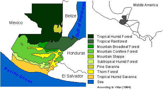
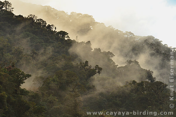
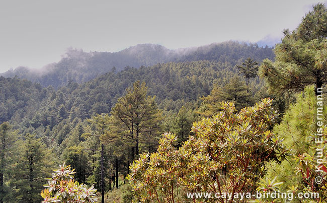
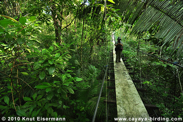
Guatemala covers approximately 109,000 km2, from sea level to 4200 m (13,800 ft). The rough topography of the mountainous southern part of the country causes a highly diverse vegetation coverage ranging from mountain broadleaf forest, mountain coniferous forest, and subtropical humid forest in the highlands, arid thorn scrub in interior valleys, and tropical humid forest, tropical rainforest and tropical humid savanna in the lowlands.
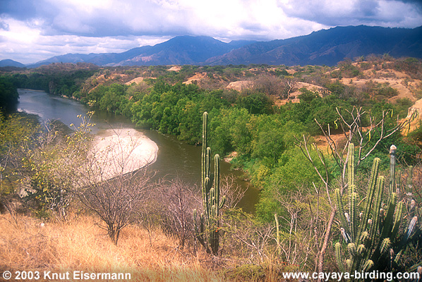
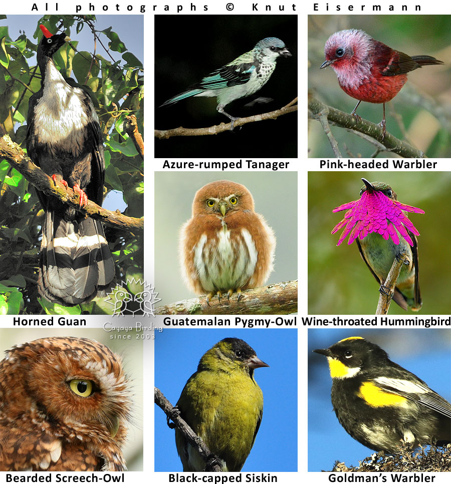
Middle America is recognized as an important endemic bird area of the world. In this regard, Guatemala covers two main areas: the Northern Central American Highlands, classified as an urgent priority for conservation, and the Northern Central American Pacific Slope, classified as a high priority (Bibby et al. 1992). Principally based on high endemism, 21 Important Bird Areas (IBA) were designated in Guatemala by BirdLife International (Eisermann & Avendaño 2009). Some of the endemic species for these regions are: Horned Guan, Highland Guan, Blue-throated Motmot, Green-throated Mountain-gem, Rufous Sabrewing, Azure-rumped Tanager, Pink-headed Warbler, Goldman's Warbler, Bearded Screech-Owl, and Fulvous Owl. More information on Guatemala's regional endemic birds.
In Central America, species from the Nearctic and the Neotropic flora and fauna crossed bio-geographic borders less than 3 million years ago. This began when the Isthmus of Panama was formed, functioning as a bridge between North and South America. Cats, raccoons, tapirs, deer, horses and llamas are examples of species groups that traveled from the north to the south. Armadillos and ant eaters are some examples of animals that migrated from the south to the north. Animals that were better adapted to lowland rain forests migrated from the Amazon basin up to the lowlands of Central America yet reached only as far as Veracruz, Mexico. Some examples of these animals are toucans, parrots, guans, agoutis, pacas, monkeys and the beautiful Morpho and Heliconius butterflies. Since this migration took place, the biodiversity of the Central American lowlands has evolved to become more similar to the Amazon than to North America. Mountain ranges of northern Central America are characterized by pine (Pinus spp.) and oak (Quercus spp.) vegetation, both trees originating in North America.
Climate
Guatemala is sometimes called land of eternal spring, however, this can be misleading. While in Guatemala you can experience comfortable spring breezes, hot and humid tropical weather and chilly nights (below 0°C).
The average annual temperature in the highlands above 3,000 meters (9,840 ft) is 15°C (59°F), while in the lowlands the average temperature is 25°C (77°F). In the lowlands the temperature can reach 40°C (104°F) or higher and the months with the highest temperatures are from April to July. Precipitation is highest on the Atlantic slope of the eastern cordillera, and ranges between 4,000 and 6,000 mm per year. By contrast, the driest areas in the Motagua valley in eastern Guatemala receive less than 600 mm of rain per year.
In Guatemala there are two seasons, as common in the climate of the northern tropics: the dry season and the rainy season. The longer season is the rainy season, which lasts from May through December and is only interrupted by a short dry season in August. The main dry season lasts from January through April.
Vulcanism and Tectonic
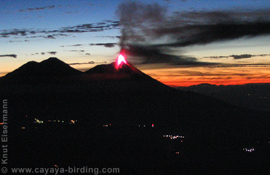
Central America is an active volcanic area, caused by the dynamics along the edges of five tectonic plates. In Guatemala the North American Plate meets the Caribbean Plate along the Motagua fault traversing the country from West to East. The Cocos Plate moves toward the North American and the Caribbean Plate, forming a subduction zone along the Middle American deep-sea trench (Weyl 1980). Plate movements cause several small earthquakes each year and several strong earthquakes with severe demage have been recorded in Guatemalan history. In Guatemala there are 33 volcanoes along the Pacific coast. The most active volcanoes in Central America are located in this volcanic chain, including the Fuego, Pacaya, and Santiaguito volcanoes, which have been active throughout the last decade. Two of the most beautiful lakes in Guatemala, Atitlán and Amatitlán, were formed by subterranean withdrawal of magma, and are examples of caldera lakes (Coates 1997).
For recent earthquake reports visit http://earthquake.usgs.gov/earthquakes/map/
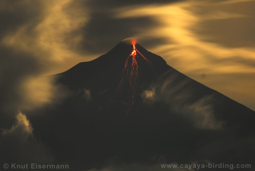
Major eruption of Fuego Volcano on 3 June 2018.
Pyroclastic flow during devastating eruption of Fuego Volcano on 3 June 2018.
Conservation
Guatemala's biodiversity receives some level of protection within the System of Protected Areas, which covers about a third of the country. Unfortunately, many of the protected areas are "paper parks", with a lack of management and true protectio in situ.
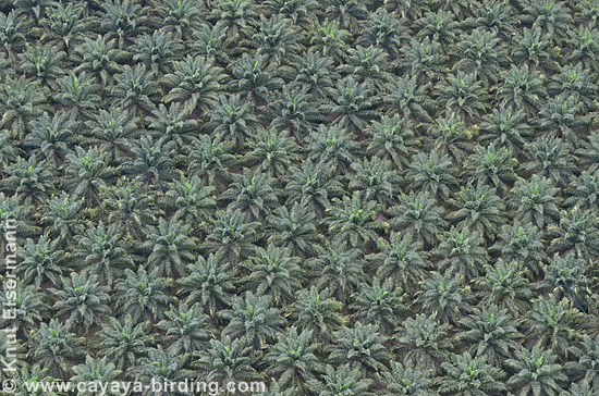
The main threats to natural resources in Guatemala are similar between protected and non-protected areas: Forest fires, expansion of the agricultural frontier, mining, illegal extraction and trading of animals for pets, and the sale of ornamental plants and precious woods. In areas close to human population centers, deforestation is the main threat since the local custom is to prepare land for farming by slashing and burning any trees or underbrush in the area to be farmed. In addition, monoculture cash crops such as oil palm plantations are expanding rapidly in Guatemala due to a lack of regulation and land use planning.
References
- Bibby, C. J., N. J.Collar, M. J. Crosby, M. F. Heath, C. Imboden, T. H. Johnson, A. J. Long, A. J. Stattersfield & S. J. Thirgood (1992): Putting biodiversity on the map: priority areas for global conservation. International Council for Bird Preservation. Cambridge. UK.
- Coates, A. (1997): Central America, a natural and cultural history. A Publication of the Paseo Pantera Project. Yale University Press.
- Eisermann, K. & C. Avendaño (2009) Guatemala. Pp. 235-242 In: C. Devenish, D. F. Diaz Fernández, R. P. Clay, I. Davidson & I. Y. Zabala (eds.) Important Bird Areas Americas, priority sites for biodiversity conservation. BirdLife Conservation Series 16. Birdlife International, Quito, Ecuador.
- Stotz, D. F., J. W. Fitzpatrick. T. A. Parker III & D. K. Moskovits (1996): Neotropical birds: ecology and conservation. University of Chicago Press. Chicago.
- Villar, L. (1994): Informe General de Pais Guatemala: Perfil General. in: Vega, A. (ed.): Conservation Corridors in the Central American Region. Proceedings of a Regional Conference Sponsored by the Paseo Pantera Project. Tropical Research and Development. Inc. U.S., 431 pp., 193-221.
- Weyl, R. (1980): Geology of Central America. Beiträge zur regionalen Geologie der Erde 15, 1-371.